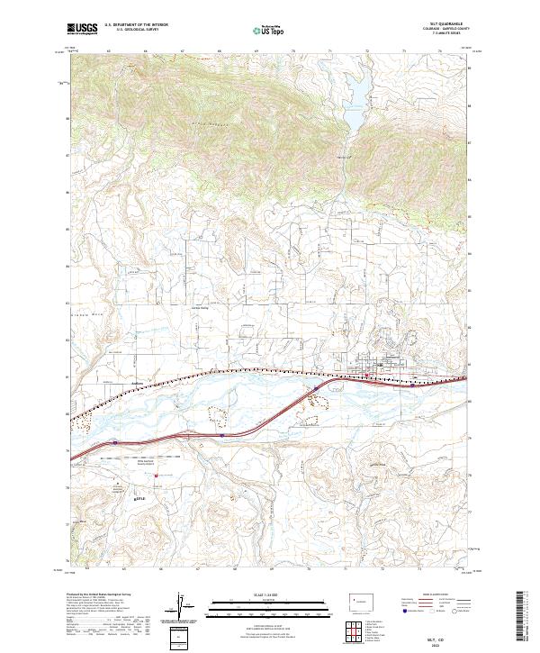
2022 Map of Silt
USGS Topo · Published 2022About this map
The Colorado River corridor defines the geography of this Garfield County landscape, where the settlement of Silt stands as a focal point for the surrounding agricultural and aviation infrastructure. North of the river, the striking geological line of the Grand Hogback rises above Cactus Valley and Harvey Gap, creating a natural barrier that has historically shaped local transit and water management. A complex network of irrigation systems, including the Farmers Irrigation Company Ditch and the Lower Cactus Valley Ditch, illustrates the intensive efforts required to cultivate the high desert terrain between the river and the mesa tops.
Find a feature on this map
105 named features on this map. Tap any name to fly to it.
Don’t see what you’re looking for? This feature index may not catch every label — zoom into the map to look around manually.
Map Details
Editions of this 2022 Silt Map
This is the sole edition of this map. No revisions or reprints were ever made.
Other maps of this area

1906 · Grand Hogback
USGS Topo · 1:125,000

1910 · Grand Hogback
USGS Topo · 1:125,000

1952 · Horse Mountain
USGS Topo · 1:24,000

1952 · Rifle
USGS Topo · 1:24,000

1957 · Leadville
USGS Topo · 1:250,000

1959 · Leadville
USGS Topo · 1:250,000

1960 · Leadville
USGS Topo · 1:250,000

1960 · North Mamm Peak
USGS Topo · 1:24,000

1962 · Leadville
USGS Topo · 1:250,000

1962 · New Castle
USGS Topo · 1:24,000