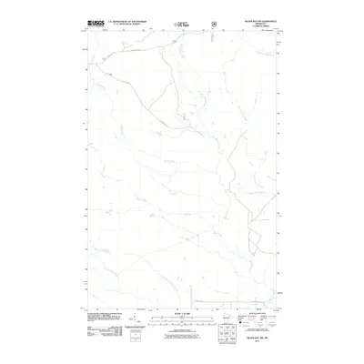
2011 Map of Silver Bay SW
USGS Topo · Published 2011About this map
The Beaver River and its intricate network of tributaries define this pocket of the North Shore backcountry in the early 21st century. The landscape is dominated by complex drainage patterns, where the Big Thirtynine Creek and Little Thirtynine Creek converge amidst a web of forest service corridors. Local transport is dictated by the rugged layout of Forest Hwy 11 and Beaver River Rd, which provide access to the timberlands and headwaters.
Find a feature on this map
11 named features on this map. Tap any name to fly to it.
Don’t see what you’re looking for? This feature index may not catch every label — zoom into the map to look around manually.
Map Details
Editions of this 2011 Silver Bay SW Map
This is the sole edition of this map. No revisions or reprints were ever made.
Other maps of this area

1953 · Whyte
USGS Topo · 1:62,500

1954 · Silver Bay
USGS Topo · 1:62,500

1954 · Two Harbors
USGS Topo · 1:250,000

1956 · Split Rock Point
USGS Topo · 1:24,000

1956 · Split Rock Point
USGS Topo · 1:62,500

1956 · Split Rock Point NE
USGS Topo · 1:24,000

1957 · Two Harbors
USGS Topo · 1:250,000

1957 · Two Harbors
USGS Topo · 1:62,500

1957 · Two Harbors NE
USGS Topo · 1:24,000

1958 · Two Harbors
USGS Topo · 1:250,000