
1954 Map of Silver Bay
USGS Topo · Published 1956About this map
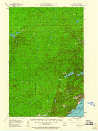
Lake Superior dominates the southeastern corner of this Lake County landscape, serving as the industrial anchor for the growing community of Silver Bay. The mid-1950s was a period of significant transition for this region of Minnesota, evidenced by the heavy industrial footprint of Mining operations and a dedicated Powerplant and Sewage Disposal system along the shoreline. Further inland, the dense timberlands of the Superior National Forest and Finland State Forest are bisected by an intricate network of timber-hauling routes, including the Old Company Railroad and various Railroad Grades. From the small settlement of Finland to the rocky coast at Beaver Bay, the terrain is defined by the high elevations of the Cloquet Lookout Tower and the dramatic descent of the Baptism River toward the lake, punctuated by Pancake Falls. Numerous small lakes, such as Lax Lake and Bear Lake, dot the interior, illustrating the classic glacial topography of the North Shore.
Find a feature on this map
49 named features on this map. Tap any name to fly to it.
Don’t see what you’re looking for? This feature index may not catch every label — zoom into the map to look around manually.
Map Details
Editions of this 1954 Silver Bay Map
3 editions found
Other maps of this area

1953 · Whyte
USGS Topo · 1:62,500

1954 · Greenwood Lake
USGS Topo · 1:62,500

1954 · Two Harbors
USGS Topo · 1:250,000

1955 · Isabella
USGS Topo · 1:62,500

1955 · Cramer
USGS Topo · 1:62,500

1956 · Split Rock Point
USGS Topo · 1:24,000

1956 · Finland
USGS Topo · 1:24,000

1956 · Finland
USGS Topo · 1:62,500

1956 · Illgen City
USGS Topo · 1:24,000

1956 · Split Rock Point
USGS Topo · 1:62,500