
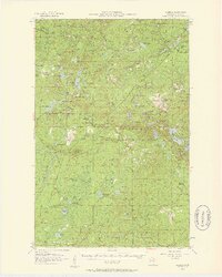
1955 Map of Isabella
USGS Topo · Published 1957About this map
Isabella and its surrounding timberlands are documented here during the mid-1950s, a period defined by the logging and rail infrastructure of the Superior National Forest. The landscape is a complex web of water and transport, where the Duluth Missabe and Iron Range railroad and various railroad grades connect remote outposts. Evidence of earlier settlement patterns is visible at the Isabella Sch (Abandoned), while active operations continue at Isabella (Station) and several namesake water-access points like Sawbill Landing and Martin Landing. Smaller settlements such as Murphy City and Manitou Junction anchor the southeastern portion of the map, while the Stony Lookout Tower provides a high-point reference for forest management. The density of lakes, from Upper Sand Lake to Lake Gegoka, illustrates the water-heavy terrain that dictated the placement of schools and seasonal camps in this corner of Lake County.
Find a feature on this map
76 named features on this map. Tap any name to fly to it.
Don’t see what you’re looking for? This feature index may not catch every label — zoom into the map to look around manually.
Map Details
Editions of this 1955 Isabella Map
4 editions found
Other maps of this area

1953 · Whyte
USGS Topo · 1:62,500

1954 · Greenwood Lake
USGS Topo · 1:62,500

1954 · Silver Bay
USGS Topo · 1:62,500

1954 · Two Harbors
USGS Topo · 1:250,000

1955 · Cramer
USGS Topo · 1:62,500

1956 · Finland
USGS Topo · 1:24,000

1956 · Finland
USGS Topo · 1:62,500

1957 · Two Harbors
USGS Topo · 1:250,000

1957 · Gabbro Lake
USGS Topo · 1:62,500

1958 · Two Harbors
USGS Topo · 1:250,000