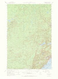
1954 Map of Silver Bay
USGS Topo · Published 1974About this map
Silver Bay emerges as a focal point of industrial development on the North Shore in this mid-century survey. The landscape is defined by the logistical needs of the taconite industry, anchored by the Reserve Mining Company Railroad and its infrastructure including a powerplant and sewage disposal facilities. This era represents a significant shift from the region's logging past, though an old railroad grade persists as a trace of earlier timber transport across the Finland State Forest.
Find a feature on this map
53 named features on this map. Tap any name to fly to it.
Don’t see what you’re looking for? This feature index may not catch every label — zoom into the map to look around manually.
Map Details
Editions of this 1954 Silver Bay Map
3 editions found
Other maps of this area

1953 · Whyte
USGS Topo · 1:62,500

1954 · Greenwood Lake
USGS Topo · 1:62,500

1954 · Silver Bay
USGS Topo · 1:62,500

1954 · Two Harbors
USGS Topo · 1:250,000

1955 · Isabella
USGS Topo · 1:62,500

1955 · Cramer
USGS Topo · 1:62,500

1956 · Split Rock Point
USGS Topo · 1:24,000

1956 · Finland
USGS Topo · 1:24,000

1956 · Finland
USGS Topo · 1:62,500

1956 · Illgen City
USGS Topo · 1:24,000