
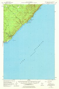
1956 Map of Split Rock Point
USGS Topo · Published 1958About this map
The Split Rock Lighthouse stands as a prominent landmark on this rugged Lake Superior shoreline, marking a dangerous stretch of coast between Little Two Harbors and Islet Bay. Surveyed in the mid-1950s, the map reveals a landscape defined by the steep descent of North Shore rivers, including the Gooseberry River and the complex drainage of the Split Rock River with its east and west branches. The inclusion of Gooseberry Falls State Park highlights the early development of this region for public recreation, while the Old RR Grade winding through Silver Creek serves as a tangible reminder of the area's logging and industrial history. From the small settlement at Castle Danger to the offshore hazards of Gooseberry Reef, the sheet captures the intersection of maritime safety, resource extraction, and the emerging tourism of the Minnesota Arrowhead region.
Find a feature on this map
22 named features on this map. Tap any name to fly to it.
Don’t see what you’re looking for? This feature index may not catch every label — zoom into the map to look around manually.
Map Details
Editions of this 1956 Split Rock Point Map
2 editions found
Other maps of this area

1943 · Port Wing
USGS Topo · 1:48,000

1944 · Cornucopia
USGS Topo · 1:48,000

1946 · Cornucopia
USGS Topo · 1:48,000

1946 · Port Wing
USGS Topo · 1:48,000

1953 · Whyte
USGS Topo · 1:62,500

1953 · Ashland
USGS Topo · 1:250,000

1954 · Silver Bay
USGS Topo · 1:62,500

1954 · Two Harbors
USGS Topo · 1:250,000

1956 · Split Rock Point
USGS Topo · 1:24,000

1956 · Finland
USGS Topo · 1:62,500