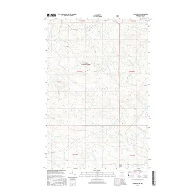
2016 Map of Silver Bay SW
USGS Topo · Published 2016About this map
Superior National Forest encompasses the vast majority of this landscape in Lake County, defining a region characterized by a complex network of waterways and timber management corridors. The Beaver River and its numerous branches, including the W Br Beaver River and E Br Beaver River, create a dense drainage pattern that dictates the local topography. Human activity is concentrated along established forest routes like Toimi Road and N Alger Grade, reflecting the region's history of logging and resource access.
Find a feature on this map
27 named features on this map. Tap any name to fly to it.
Don’t see what you’re looking for? This feature index may not catch every label — zoom into the map to look around manually.
Map Details
Editions of this 2016 Silver Bay SW Map
This is the sole edition of this map. No revisions or reprints were ever made.
Other maps of this area

1953 · Whyte
USGS Topo · 1:62,500

1954 · Silver Bay
USGS Topo · 1:62,500

1954 · Two Harbors
USGS Topo · 1:250,000

1956 · Split Rock Point
USGS Topo · 1:24,000

1956 · Split Rock Point
USGS Topo · 1:62,500

1956 · Split Rock Point NE
USGS Topo · 1:24,000

1957 · Two Harbors
USGS Topo · 1:250,000

1957 · Two Harbors
USGS Topo · 1:62,500

1957 · Two Harbors NE
USGS Topo · 1:24,000

1958 · Two Harbors
USGS Topo · 1:250,000