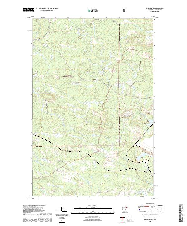
2022 Map of Silver Bay SW
USGS Topo · Published 2022About this map
The Superior National Forest dominates this landscape in northeastern Minnesota, providing a clear record of the watershed and timber-related transport network of Lake County. This area is defined by the complex branching of the Beaver River and its major tributaries, including the W Br Beaver River and the winding course of Big Thirtymine Cr. The map documents a rugged interior where old logging and transport routes like the N Alger Grade and Toimi Road cut through the forest, reflecting the historical infrastructure of the North Shore highlands. To the south, the headwaters of the E Split Rock River and W Split Rock River begin their descent toward Lake Superior. This survey provides genealogists and land researchers a precise view of the section lines and township boundaries, such as t56n r9w, that organized these remote forest lands.
Find a feature on this map
22 named features on this map. Tap any name to fly to it.
Don’t see what you’re looking for? This feature index may not catch every label — zoom into the map to look around manually.
Map Details
Editions of this 2022 Silver Bay SW Map
This is the sole edition of this map. No revisions or reprints were ever made.
Other maps of this area

1953 · Whyte
USGS Topo · 1:62,500

1954 · Silver Bay
USGS Topo · 1:62,500

1954 · Two Harbors
USGS Topo · 1:250,000

1956 · Split Rock Point
USGS Topo · 1:24,000

1956 · Split Rock Point
USGS Topo · 1:62,500

1956 · Split Rock Point NE
USGS Topo · 1:24,000

1957 · Two Harbors
USGS Topo · 1:250,000

1957 · Two Harbors
USGS Topo · 1:62,500

1957 · Two Harbors NE
USGS Topo · 1:24,000

1958 · Two Harbors
USGS Topo · 1:250,000