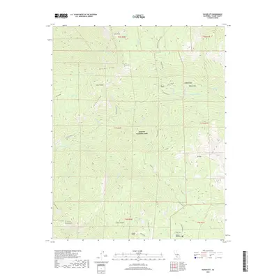
2018 Map of Silver City
USGS Topo · Published 2018About this map
Silver City and Cabin Cove represent the primary human footprints within this high-elevation landscape, situated along the winding path of Mineral King Rd. Most of the terrain is protected as part of Sequoia National Park, where the E Fork Kaweah River is fed by a complex drainage system including Atwell Cr, Deadwood Cr, and Horse Cr. The topography is defined by significant granite formations and high ridges, including the prominent Castle Rocks, Paradise Ridge, and Conifer Ridge.
Find a feature on this map
45 named features on this map. Tap any name to fly to it.
Don’t see what you’re looking for? This feature index may not catch every label — zoom into the map to look around manually.
Map Details
Editions of this 2018 Silver City Map
This is the sole edition of this map. No revisions or reprints were ever made.
Other maps of this area

1903 · Tehipite
USGS Topo · 1:125,000

1904 · Kaweah
USGS Topo · 1:125,000

1905 · Tehipite
USGS Topo · 1:125,000

1909 · Kaweah
USGS Topo · 1:125,000

1937 · Kaweah
USGS Topo · 1:125,000

1948 · Fresno
USGS Topo · 1:250,000

1955 · Fresno
USGS Topo · 1:250,000

1956 · Fresno
USGS Topo · 1:250,000

1956 · Giant Forest
USGS Topo · 1:62,500

1956 · Mineral King
USGS Topo · 1:62,500