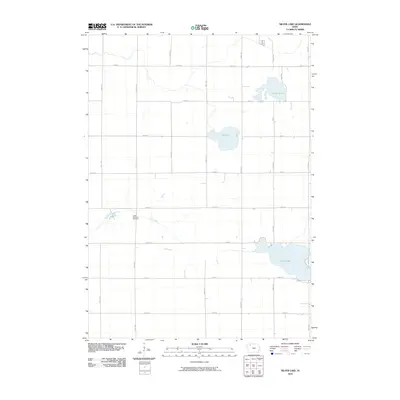
2010 Map of Silver Lake
USGS Topo · Published 2010About this map
Logan Township Cemetery serves as a quiet landmark within the rural landscape of Clay County, Iowa. The area is defined by a series of prominent water bodies, including the larger Silver Lake in the southeast and the smaller Virgin Lake and Elk Lake to the north. These lakes are connected by a network of drainage, most notably Elk Creek, which meanders through the central and western sections of the quadrangle. The human footprint is marked by a strict grid of section roads, such as 350th Ave and 400th St, characteristic of the Midwestern township and range survey system. This 2010 digital representation captures the region as it existed before further modern development, preserving the layout of family farms and the original watercourses that have shaped local agriculture for generations.
Find a feature on this map
21 named features on this map. Tap any name to fly to it.
Don’t see what you’re looking for? This feature index may not catch every label — zoom into the map to look around manually.
Map Details
Editions of this 2010 Silver Lake Map
This is the sole edition of this map. No revisions or reprints were ever made.
Other maps of this area

1954 · Fairmont
USGS Topo · 1:250,000

1954 · Fort Dodge
USGS Topo · 1:250,000

1957 · Fort Dodge
USGS Topo · 1:250,000

1958 · Fort Dodge
USGS Topo · 1:250,000

1958 · Fairmont
USGS Topo · 1:250,000

1966 · Gillett Grove
USGS Topo · 1:24,000

1966 · Dickens
USGS Topo · 1:24,000

1971 · Rush Lake East
USGS Topo · 1:24,000

1971 · Rush Lake West
USGS Topo · 1:24,000

1971 · Webb
USGS Topo · 1:24,000