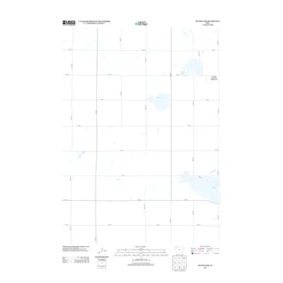
2013 Map of Silver Lake
USGS Topo · Published 2013About this map
Glacial prairie potholes and watercourses define the landscape of Clay County, Iowa, in this detailed look at its rural topography. The sheet is dominated by several significant water bodies, including Silver Lake at the eastern edge and the centrally located Elk Lake. These natural features are complemented by the conservation efforts visible at the Little-Bit-of-Prairie Wildlife Area near Virgin Lake. The map reveals a strictly regulated section-line road network, where numbered corridors like 380th St and 350th Ave grid the terrain, only deviating for local landmarks such as Lovers Ln. Water management is evident through the inclusion of Ditch Number 6, reflecting the region's agricultural drainage history, while the natural path of Elk Cr provides a counterpoint to the man-made canals and straight-line boundaries.
Find a feature on this map
23 named features on this map. Tap any name to fly to it.
Don’t see what you’re looking for? This feature index may not catch every label — zoom into the map to look around manually.
Map Details
Editions of this 2013 Silver Lake Map
This is the sole edition of this map. No revisions or reprints were ever made.
Other maps of this area

1954 · Fairmont
USGS Topo · 1:250,000

1954 · Fort Dodge
USGS Topo · 1:250,000

1957 · Fort Dodge
USGS Topo · 1:250,000

1958 · Fort Dodge
USGS Topo · 1:250,000

1958 · Fairmont
USGS Topo · 1:250,000

1966 · Gillett Grove
USGS Topo · 1:24,000

1966 · Dickens
USGS Topo · 1:24,000

1971 · Rush Lake East
USGS Topo · 1:24,000

1971 · Rush Lake West
USGS Topo · 1:24,000

1971 · Webb
USGS Topo · 1:24,000