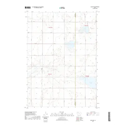
2018 Map of Silver Lake
USGS Topo · Published 2018About this map
Silver Lake and the wetlands along the boundary of Clay and Palo Alto Counties define this agricultural landscape in northwestern Iowa. The terrain is characterized by glacial depression lakes including Elk Lake and Virgin Lake, which sit amidst a grid of section roads and drainage features like Ditch Number 6. The rural character is punctuated by quiet landmarks such as the Logan Township Cem, located near the intersection of Co Hwy N 14 and 410th St. One of the more unique local designations is the stretch of road labeled Hwy To Heaven running east-west toward the lake. The map details the precise township and range lines, such as t95n r34w, that have organized this prairie region into its characteristic square-mile farm blocks, while Elk Cr provides natural drainage through the northern reaches.
Find a feature on this map
30 named features on this map. Tap any name to fly to it.
Don’t see what you’re looking for? This feature index may not catch every label — zoom into the map to look around manually.
Map Details
Editions of this 2018 Silver Lake Map
This is the sole edition of this map. No revisions or reprints were ever made.
Other maps of this area

1954 · Fairmont
USGS Topo · 1:250,000

1954 · Fort Dodge
USGS Topo · 1:250,000

1957 · Fort Dodge
USGS Topo · 1:250,000

1958 · Fort Dodge
USGS Topo · 1:250,000

1958 · Fairmont
USGS Topo · 1:250,000

1966 · Gillett Grove
USGS Topo · 1:24,000

1966 · Dickens
USGS Topo · 1:24,000

1971 · Rush Lake East
USGS Topo · 1:24,000

1971 · Rush Lake West
USGS Topo · 1:24,000

1971 · Webb
USGS Topo · 1:24,000