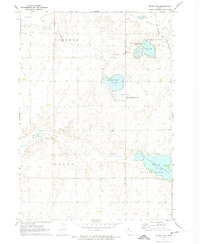
1972 Map of Silver Lake
USGS Topo · Published 1974About this map
Silver Lake and its surrounding wetlands dominate this landscape along the border of Clay Co and Palo Alto Co during the early 1970s. The region is defined by a series of protected natural spaces, including the Virgin Lake State Game Management Area and the Elk Lake State Game Management Area, illustrating a post-war commitment to conservation and wildlife habitat in the Iowa prairie-pothole region. In the northeast, the Chicago and North Western railroad cuts across the corner of Highland, providing a vital transit link for the local agricultural economy.
Find a feature on this map
20 named features on this map. Tap any name to fly to it.
Don’t see what you’re looking for? This feature index may not catch every label — zoom into the map to look around manually.
Map Details
Editions of this 1972 Silver Lake Map
This is the sole edition of this map. No revisions or reprints were ever made.
Other maps of this area

1954 · Fairmont
USGS Topo · 1:250,000

1954 · Fort Dodge
USGS Topo · 1:250,000

1957 · Fort Dodge
USGS Topo · 1:250,000

1958 · Fort Dodge
USGS Topo · 1:250,000

1958 · Fairmont
USGS Topo · 1:250,000

1966 · Gillett Grove
USGS Topo · 1:24,000

1966 · Dickens
USGS Topo · 1:24,000

1971 · Rush Lake East
USGS Topo · 1:24,000

1971 · Rush Lake West
USGS Topo · 1:24,000

1971 · Webb
USGS Topo · 1:24,000