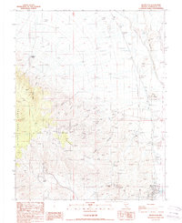
1987 Map of Silver Peak
USGS Topo · Published 1987About this map
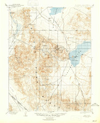
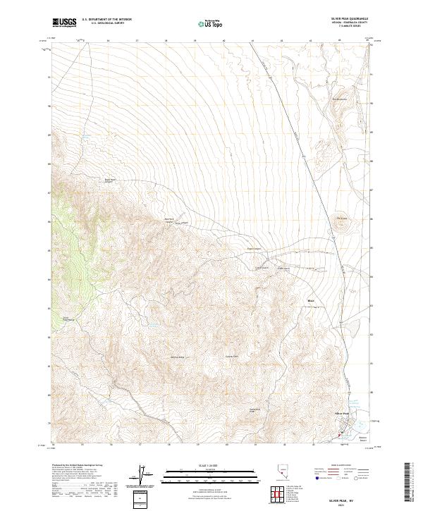
Mining history defines this arid reach of the Silver Peak Range, where a network of trails and an Old Railroad Grade connect high-desert claims to the valley floor. The landscape is marked by numerous historic operations, including the Oro Monte Mine, Drinkwater Mine, and Last Chance Mine, all clustered near Custer Gulch. The settlement of Silver Peak serves as a central hub, accompanied by the town of Blair and several Ruins that indicate the area's once-booming extraction economy.
Find a feature on this map
41 named features on this map. Tap any name to fly to it.
Don’t see what you’re looking for? This feature index may not catch every label — zoom into the map to look around manually.
Map Details
Editions of this 1987 Silver Peak Map
This is the sole edition of this map. No revisions or reprints were ever made.
Historical Maps of Silver Peak Through Time
7 maps found