
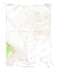
1963 Map of Silver Peak
USGS Topo · Published 1965About this map
The Silver Peak settlement serves as the anchor for this desert landscape, situated at the edge of the expansive Clayton Valley near Hot Spring and a series of Tailings Ponds. The industrial footprint of the early 1960s is evident in the remains of the Old Railroad Grade which snakes toward the former site of Blair, reflecting the era's mining and transport history. To the west, the Silver Peak Range rises sharply, featuring landmarks like Vanderbilt Peak and the Mary Mine.
Find a feature on this map
39 named features on this map. Tap any name to fly to it.
Don’t see what you’re looking for? This feature index may not catch every label — zoom into the map to look around manually.
Map Details
Editions of this 1963 Silver Peak Map
2 editions found
Other maps of this area

1898 · Silver Peak
USGS Topo · 1:125,000

1900 · Silver Peak
USGS Topo · 1:125,000

1907 · Tonopah
USGS Topo · 1:250,000

1908 · Lida
USGS Topo · 1:250,000

1908 · Tonopah
USGS Topo · 1:250,000

1913 · Lida
USGS Topo · 1:250,000

1945 · Goldfield
USGS Topo · 1:125,000

1954 · Goldfield
USGS Topo · 1:250,000

1955 · Goldfield
USGS Topo · 1:250,000

1956 · Tonopah
USGS Topo · 1:250,000