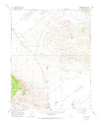
1963 Map of Silverpeak
USGS Topo · Published 1974About this map
Silverpeak stands at the southern edge of this 1963 survey, serving as a focal point for industrial activity evidenced by its Substation and proximity to Tailings Ponds. The desert landscape is defined by the stark transition from the Big Smoky Valley to the uplifted Mineral Ridge and the Silver Peak Range. A significant historical trace is found in the Old Railroad Grade, which snakes northward toward the former settlement of Blair, connecting the mining operations of the hills to the valley floor. To the east, the Weepah Hills hide the community of Weepah and several prospects, reflecting the era's persistent mineral exploration. Geological landmarks like The Monocline and The Crater disrupt the flat expanse of Clayton Valley, where Angel Island and Goat Island rise as prominent topographic features amidst the arid surroundings.
Find a feature on this map
34 named features on this map. Tap any name to fly to it.
Don’t see what you’re looking for? This feature index may not catch every label — zoom into the map to look around manually.
Map Details
Editions of this 1963 Silverpeak Map
2 editions found

Other maps of this area

1898 · Silver Peak
USGS Topo · 1:125,000

1900 · Silver Peak
USGS Topo · 1:125,000

1907 · Tonopah
USGS Topo · 1:250,000

1908 · Lida
USGS Topo · 1:250,000

1908 · Tonopah
USGS Topo · 1:250,000

1913 · Lida
USGS Topo · 1:250,000

1945 · Goldfield
USGS Topo · 1:125,000

1954 · Goldfield
USGS Topo · 1:250,000

1955 · Goldfield
USGS Topo · 1:250,000

1956 · Tonopah
USGS Topo · 1:250,000