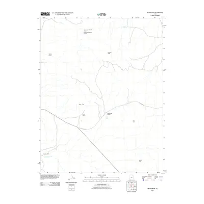
2011 Map of Silver Peak
USGS Topo · Published 2011About this map
Silver Peak and the surrounding Antelope Range define this high-desert region of Iron County, Utah. The landscape is deeply incised by drainages such as North Fork Chloride Canyon and Bullion Canyon, reflecting a topography shaped by geologic action and seasonal water flow. Human presence is marked by Desert Mound Rd, which cuts through the southern half of the quadrangle, passing between the Red Hills and the Miner Hill area. This map documents a series of vital water sources in an arid environment, including Joel Spring, Sand Spring, and Hidden Spring. The transition from the alluvial fans of The Dry Wash to the peaks and canyons illustrates the classic Basin and Range terrain typical of this part of southern Utah. Researchers can trace the path of Little Pinto Creek as it interacts with the complex system of canyons and ridges that define the local hydrology and elevation.
Find a feature on this map
15 named features on this map. Tap any name to fly to it.
Don’t see what you’re looking for? This feature index may not catch every label — zoom into the map to look around manually.
Map Details
Editions of this 2011 Silver Peak Map
This is the sole edition of this map. No revisions or reprints were ever made.
Other maps of this area

1885 · St. George
USGS Topo · 1:250,000

1891 · St. George
USGS Topo · 1:250,000

1950 · Antelope Peak
USGS Topo · 1:24,000

1950 · Iron Mountain
USGS Topo · 1:62,500

1950 · Stoddard Mtn
USGS Topo · 1:24,000

1950 · Silver Peak
USGS Topo · 1:24,000

1950 · Desert Mound
USGS Topo · 1:24,000

1950 · Page Ranch
USGS Topo · 1:24,000

1950 · Avon SE
USGS Topo · 1:24,000

1951 · Avon SE
USGS Topo · 1:24,000