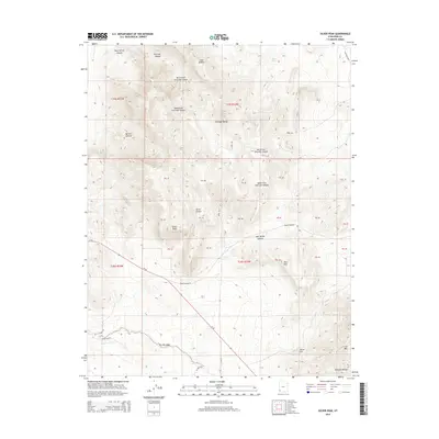
2014 Map of Silver Peak
USGS Topo · Published 2014About this map
Silver Peak dominates the central landscape of this Iron County survey, rising above a network of canyons and high desert terrain. The area is defined by its mining-related geography, with features like Bullion Canyon and Miner Hill suggesting the extractive history that shaped this part of the Antelope Range. In the southern portion of the sheet, the landscape transitions toward Iron Mtn, while the seasonal hydrology is marked by The Dry Wash and Little Pinto Creek. Scattered water sources such as Joel Spring, Sand Spring, and Hidden Spring appear as critical points in an otherwise arid environment. This 2014 edition documents the modern roadway network, including Ut-56 and Desert Mound Road, which provide access through the rugged canyons of the North Fork Chloride Canyon and South Fork Chloride Canyon.
Find a feature on this map
29 named features on this map. Tap any name to fly to it.
Don’t see what you’re looking for? This feature index may not catch every label — zoom into the map to look around manually.
Map Details
Editions of this 2014 Silver Peak Map
This is the sole edition of this map. No revisions or reprints were ever made.
Other maps of this area

1885 · St. George
USGS Topo · 1:250,000

1891 · St. George
USGS Topo · 1:250,000

1950 · Antelope Peak
USGS Topo · 1:24,000

1950 · Iron Mountain
USGS Topo · 1:62,500

1950 · Stoddard Mtn
USGS Topo · 1:24,000

1950 · Silver Peak
USGS Topo · 1:24,000

1950 · Desert Mound
USGS Topo · 1:24,000

1950 · Page Ranch
USGS Topo · 1:24,000

1950 · Avon SE
USGS Topo · 1:24,000

1951 · Avon SE
USGS Topo · 1:24,000