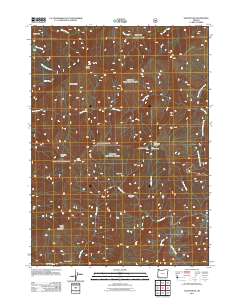
2011 Map of Silver Peak
USGS Topo · Published 2011About this map
Silver Peak rises above a landscape defined by sharp drainage basins and expansive high-elevation clearings in this Josephine County survey. The Illinois River cuts through the southwestern quadrant, creating notable landmarks such as Deadman Bar and the sheer face of the Green Wall. This area is characterized by a series of distinct upland meadows, including Silver Prairie, Middle Bald Prairie, and Little Bald Mountain Prairie, which suggest a history of natural openings or perhaps historical grazing sites. Remote outposts and seasonal locations like Fantz Ranch, West Ridge Camp, and Bald Mountain Camp are scattered across the terrain, connected by limited forest access routes. The complex water network is anchored by Silver Creek and its branches, alongside numerous tributaries such as Sulphur Creek and Florence Creek that feed into the larger river system, illustrating the intricate hydrology of the Oregon backcountry.
Find a feature on this map
28 named features on this map. Tap any name to fly to it.
Don’t see what you’re looking for? This feature index may not catch every label — zoom into the map to look around manually.
Map Details
Editions of this 2011 Silver Peak Map
This is the sole edition of this map. No revisions or reprints were ever made.
Other maps of this area

1899 · Port Orford
USGS Topo · 1:125,000

1903 · Port Orford
USGS Topo · 1:125,000

1917 · Kerby
USGS Topo · 1:125,000

1918 · Kerby
USGS Topo · 1:125,000

1945 · Kerby
USGS Topo · 1:125,000

1954 · Coos Bay
USGS Topo · 1:250,000

1954 · Marial
USGS Topo · 1:62,500

1954 · Collier Butte
USGS Topo · 1:62,500

1954 · Agness
USGS Topo · 1:62,500

1954 · Pearsoll Peak
USGS Topo · 1:62,500