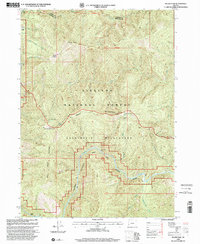
1998 Map of Silver Peak
USGS Topo · Published 2001About this map
Siskiyou National Forest and the Kalmiopsis Wilderness dominate this 1990s landscape at the border of Curry and Josephine counties. The terrain is defined by the steep descent toward the Illinois River, which is designated here as the Illinois Wild and Scenic River. Isolated outposts of human activity appear in the upper reaches of the watershed, including Graves, Fantz Ranch, and high-altitude locations like West Ridge Camp and Bald Mountain Camp.
Find a feature on this map
36 named features on this map. Tap any name to fly to it.
Don’t see what you’re looking for? This feature index may not catch every label — zoom into the map to look around manually.
Map Details
Editions of this 1998 Silver Peak Map
This is the sole edition of this map. No revisions or reprints were ever made.
Other maps of this area

1899 · Port Orford
USGS Topo · 1:125,000

1903 · Port Orford
USGS Topo · 1:125,000

1917 · Kerby
USGS Topo · 1:125,000

1918 · Kerby
USGS Topo · 1:125,000

1945 · Kerby
USGS Topo · 1:125,000

1954 · Coos Bay
USGS Topo · 1:250,000

1954 · Marial
USGS Topo · 1:62,500

1954 · Collier Butte
USGS Topo · 1:62,500

1954 · Agness
USGS Topo · 1:62,500

1954 · Pearsoll Peak
USGS Topo · 1:62,500