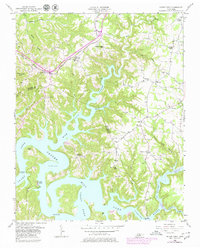
1956 Map of Silver Point
USGS Topo · Published 1980About this map
Center Hill Lake dominates the landscape in this mid-century survey, its fingers reaching deep into the winding valleys of the Caney Fork and Falling Water River. The flooding of these valleys transformed the region, yet the map preserves the older upland settlement patterns around Silver Point and Williams Crossroads. The map is particularly rich in rural educational and spiritual landmarks, documenting sites like Herrens Chapel Sch, Carrs Chapel Sch, and the Rock Castle Sch. These small community hubs, alongside numerous unnamed cemeteries, trace the genealogical footprint of the Putnam and De Kalb county line. Infrastructure like the Louisville and Nashville railroad and the Hurricane Bridge provide a window into the transportation networks that sustained these hills before and after the reservoir's creation.
Find a feature on this map
52 named features on this map. Tap any name to fly to it.
Don’t see what you’re looking for? This feature index may not catch every label — zoom into the map to look around manually.
Map Details
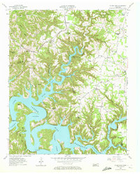
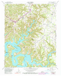
Editions of this 1956 Silver Point Map
4 editions found

Other maps of this area

1893 · Mc Minnville
USGS Topo · 1:125,000

1895 · Mc Minnville
USGS Topo · 1:125,000

1928 · Gordonsville
USGS Topo · 1:62,500

1942 · Statesville
USGS Topo · 1:100,000

1943 · Cookeville
USGS Topo · 1:100,000

1944 · Cookeville
USGS Topo · 1:100,000

1953 · Chattanooga
USGS Topo · 1:250,000

1953 · Cookeville West
USGS Topo · 1:24,000

1955 · Baxter
USGS Topo · 1:24,000
1956 · Burgess Falls
USGS Topo · 1:24,000