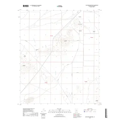
2018 Map of Silver Reef Mountains
USGS Topo · Published 2018About this map
The Silver Reef Mountains dominate this Sonoran Desert landscape, rising above a network of ephemeral drainages and scattered rural settlements. The drainage patterns of Silver Reef Wash and Greene Wash dictate the topography, carving paths through the Silver Reef Valley and toward the smaller Shopishk Valley to the east. Human settlement is concentrated in the northern reaches, where Chuichu and Shopishk are situated near the prominent White Horse Pass. To the southwest, the Tat Momoli Mountains loom, while the Sawtooth Mountains are visible at the southeastern edge of the quadrangle. Transport across this arid terrain is facilitated by several named Indian Routes and local roads, including Indian Rte 44 and Indian Rte 53, which connect the isolated valleys and mountain passes. The map illustrates a landscape where natural geological formations like Silver Reef Pass remain the primary landmarks for navigation.
Find a feature on this map
22 named features on this map. Tap any name to fly to it.
Don’t see what you’re looking for? This feature index may not catch every label — zoom into the map to look around manually.
Map Details
Editions of this 2018 Silver Reef Mountains Map
This is the sole edition of this map. No revisions or reprints were ever made.
Other maps of this area

1922 · Casa Grande
USGS Topo · 1:62,500

1922 · Signal Peak
USGS Topo · 1:62,500

1924 · Signal Peak
USGS Topo · 1:62,500

1924 · Casa Grande
USGS Topo · 1:62,500

1942 · Silver Reef Mountains
USGS Topo · 1:62,500

1947 · Eloy
USGS Topo · 1:62,500

1948 · Eloy
USGS Topo · 1:62,500

1956 · Tucson
USGS Topo · 1:250,000

1958 · Tucson
USGS Topo · 1:250,000

1959 · Tucson
USGS Topo · 1:250,000