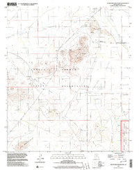
1996 Map of Silver Reef Mountains
USGS Topo · Published 2003About this map
Chuichu and the high peaks of the Silver Reef Mountains anchor this landscape within the Tohono O'odham Indian Reservation. The area reflects a significant legacy of hard-rock mining, with several named operations scattered across the desert terrain. Among these are the Magnesium Queen Mines, the Old Jonah Mine, and the Copper Standard Mines, connected by a network of unimproved roads and washes.
Find a feature on this map
32 named features on this map. Tap any name to fly to it.
Don’t see what you’re looking for? This feature index may not catch every label — zoom into the map to look around manually.
Map Details
Editions of this 1996 Silver Reef Mountains Map
This is the sole edition of this map. No revisions or reprints were ever made.
Other maps of this area

1922 · Casa Grande
USGS Topo · 1:62,500

1922 · Signal Peak
USGS Topo · 1:62,500

1924 · Signal Peak
USGS Topo · 1:62,500

1924 · Casa Grande
USGS Topo · 1:62,500

1942 · Silver Reef Mountains
USGS Topo · 1:62,500

1947 · Eloy
USGS Topo · 1:62,500

1948 · Eloy
USGS Topo · 1:62,500

1956 · Tucson
USGS Topo · 1:250,000

1958 · Tucson
USGS Topo · 1:250,000

1959 · Tucson
USGS Topo · 1:250,000