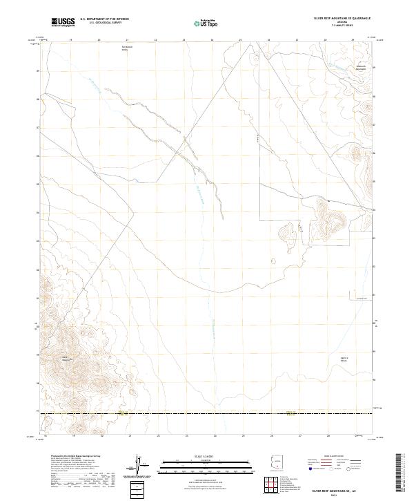
2021 Map of Silver Reef Mountains SE
USGS Topo · Published 2021About this map
The Slate Mountains dominate the southwestern portion of this landscape, where the rugged peaks overlook the expansive Tat Momoli Valley. This high-desert terrain is defined by its complex drainage network, most notably the winding course of Tat Momoli Wash and the northern Silver Reef Wash. The map documents a sparsely settled region at the boundary of Pinal and Pima counties, where the vast desert floor of the Aguirre Valley meets isolated ridges like the Sawtooth Mountains. Human development is concentrated along a few named corridors such as W Aries Dr and W Hydrus Ave, illustrating the intersection of modern road grids with traditional land divisions. The presence of the Townships T9S through T11S across ranges R5E and R6E provides a precise cadastral framework for those researching regional land ownership and early desert surveying.
Find a feature on this map
15 named features on this map. Tap any name to fly to it.
Don’t see what you’re looking for? This feature index may not catch every label — zoom into the map to look around manually.
Map Details
Editions of this 2021 Silver Reef Mountains SE Map
This is the sole edition of this map. No revisions or reprints were ever made.
Other maps of this area

1934 · Silver Bell
USGS Topo · 1:125,000

1942 · Silver Reef Mountains
USGS Topo · 1:62,500

1947 · Eloy
USGS Topo · 1:62,500

1948 · Eloy
USGS Topo · 1:62,500

1956 · Tucson
USGS Topo · 1:250,000

1958 · Tucson
USGS Topo · 1:250,000

1959 · Tucson
USGS Topo · 1:250,000

1959 · Vaca Hills
USGS Topo · 1:62,500

1962 · Tucson
USGS Topo · 1:250,000
1963 · Santa Rosa Mountains
USGS Topo · 1:62,500