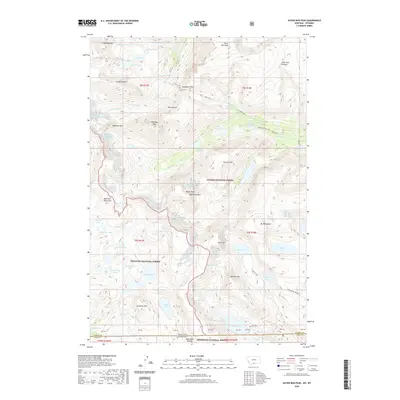
2020 Map of Silver Run Peak
USGS Topo · Published 2020About this map
The high alpine crest of the Beartooth Mountains dominates this high-altitude survey, where three major federal land reserves—the Custer National Forest, Gallatin National Forest, and Shoshone National Forest—converge at the Montana-Wyoming border. This landscape is defined by its massive plateaus and glacial features, including the Silver Run Plateau and the prominent Silver Run Peak. The hydrography of the region is characterized by dozens of high-elevation basins such as Lonesome Lake, Keyser Brown Lake, and the Silt Lakes, many of which are fed by the remnants of the Grasshopper Glacier and Beartooth Glacier. Significant summits like Whitetail Peak and Medicine Mtn overlook the deep drainages of the Lake Fork, illustrating the stark, glaciated topography of this wilderness corridor.
Find a feature on this map
76 named features on this map. Tap any name to fly to it.
Don’t see what you’re looking for? This feature index may not catch every label — zoom into the map to look around manually.
Map Details
Editions of this 2020 Silver Run Peak Map
This is the sole edition of this map. No revisions or reprints were ever made.
Other maps of this area

1896 · Crandall Creek
USGS Topo · 1:125,000

1898 · Granite Mountain District
USGS Topo · 1:125,000

1899 · Crandall
USGS Topo · 1:125,000

1950 · Deep Lake
USGS Topo · 1:62,500

1954 · Billings
USGS Topo · 1:250,000

1955 · Cody
USGS Topo · 1:250,000

1956 · Alpine
USGS Topo · 1:62,500

1956 · Mount Maurice
USGS Topo · 1:62,500

1956 · Beartooth Butte
USGS Topo · 1:62,500

1957 · Billings
USGS Topo · 1:250,000