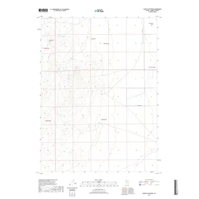
2018 Map of Silver State Draw
USGS Topo · Published 2018About this map
Slumbering Hills dominate the western portion of this Great Basin landscape, rising sharply from the expanse of Silver State Valley. This high-desert terrain is defined by its critical water sources, with several named seeps such as Davetown Spring and Wilder Spring punctuating the arid slopes. The western ridge-line is particularly dense with features like Sheepherder Spring and a cluster of livestock or ranching-related points including Circle Bar Number 1 Spring, Circle Bar Number 2 Spring, and Circle Bar Number 3 Spring. These landmarks, along with Squaw Peak, provide essential orientation in a region where historical travel followed the contours of the land. Silver State Draw cuts through the central section, while Sand Pass Rd provides the primary north-south passage through the valley floor to the east.
Find a feature on this map
16 named features on this map. Tap any name to fly to it.
Don’t see what you’re looking for? This feature index may not catch every label — zoom into the map to look around manually.
Map Details
Editions of this 2018 Silver State Draw Map
This is the sole edition of this map. No revisions or reprints were ever made.
Other maps of this area

1882 · Paradise
USGS Topo · 1:250,000

1886 · Disaster
USGS Topo · 1:250,000

1893 · Paradise
USGS Topo · 1:250,000

1893 · Disaster
USGS Topo · 1:250,000

1954 · Vya
USGS Topo · 1:250,000

1955 · McDermitt
USGS Topo · 1:250,000

1958 · Vya
USGS Topo · 1:250,000

1958 · Awakening Peak
USGS Topo · 1:62,500

1959 · McDermitt
USGS Topo · 1:250,000

1962 · Vya
USGS Topo · 1:250,000