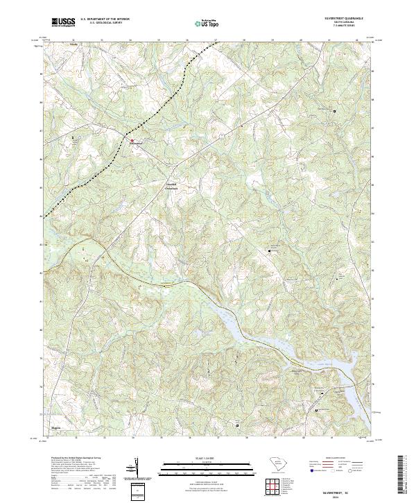
2024 Map of Silverstreet
USGS Topo · Published 2024About this map
The Saluda River corridor defines the southern landscape of this region, marking the boundary between Newberry and Saluda counties. This area is characterized by a network of rural settlements like Silverstreet and Deadfall Crossroads, connected by historic transit points where the river widens into Lake Murray. The presence of Bauknight Ferry and Kempsons Ferry indicates the historic importance of river crossings for local commerce and travel before modern bridge infrastructure dominated the landscape.
Find a feature on this map
83 named features on this map. Tap any name to fly to it.
Don’t see what you’re looking for? This feature index may not catch every label — zoom into the map to look around manually.
Map Details
Editions of this 2024 Silverstreet Map
This is the sole edition of this map. No revisions or reprints were ever made.
Other maps of this area

1941 · Spartanburg
USGS Topo · 1:250,000

1953 · Spartanburg
USGS Topo · 1:250,000

1960 · Spartanburg
USGS Topo · 1:250,000

1963 · Spartanburg
USGS Topo · 1:250,000

1964 · Spartanburg
USGS Topo · 1:250,000

1968 · Newberry East
USGS Topo · 1:24,000

1969 · Newberry West
USGS Topo · 1:24,000
1970 · Prosperity
USGS Topo · 1:24,000
1970 · Bush River
USGS Topo · 1:24,000
1970 · Delmar
USGS Topo · 1:24,000