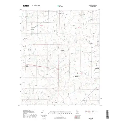
2020 Map of Simcoe
USGS Topo · Published 2020About this map
Duck River winds through the heart of this Cullman County landscape, serving as a central geographic anchor for numerous small communities and family landmarks. The area is defined by its agrarian roots and a network of historic burial grounds, such as Oak Level Cem and Welti Cem, which provide essential touchpoints for genealogical research. Crossings like Thornton Bridge and Tanner Bridge highlight the traditional routes through the drainage basins of Indian Creek and Copperas Branch.
Find a feature on this map
172 named features on this map. Tap any name to fly to it.
Don’t see what you’re looking for? This feature index may not catch every label — zoom into the map to look around manually.
Map Details
Editions of this 2020 Simcoe Map
This is the sole edition of this map. No revisions or reprints were ever made.
Other maps of this area

1888 · Cullman
USGS Topo · 1:125,000

1892 · Cullman
USGS Topo · 1:125,000

1936 · Hulaco
USGS Topo · 1:24,000

1936 · Eva
USGS Topo · 1:24,000

1936 · Lawrence Cove
USGS Topo · 1:24,000

1936 · Holly Pond
USGS Topo · 1:24,000
1949 · Hulaco
USGS Topo · 1:24,000
1949 · Lawrence Cove
USGS Topo · 1:24,000
1949 · Eva
USGS Topo · 1:24,000
1951 · Lawrence Cove
USGS Topo · 1:24,000