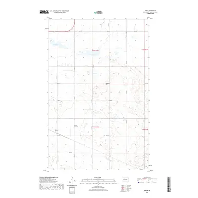
2020 Map of Simcoe
USGS Topo · Published 2020About this map
Simcoe serves as the primary focal point of this McHenry County prairie landscape, appearing as a modest junction where the rail line once influenced local development. To the east, the Stenkjaer Lutheran Cem stands as a significant genealogical marker, documenting the heritage of the Scandinavian settlers who farmed these plains. The terrain is defined by the unique glacial topography of the region, featuring prominent rises like Mikes Peak and the Henderson Hills. This environment is characterized by a high density of small wetlands and ephemeral water bodies, including Oslie Lake, Carvers Lake, and Nead Lake. The rectilinear grid of section-line roads, such as 57th St N and 50th St N, underscores the systematic division of the land for agriculture, while the winding path of River Dr N in the southeast corner indicates the influence of natural drainage on local transit.
Find a feature on this map
22 named features on this map. Tap any name to fly to it.
Don’t see what you’re looking for? This feature index may not catch every label — zoom into the map to look around manually.
Map Details
Editions of this 2020 Simcoe Map
This is the sole edition of this map. No revisions or reprints were ever made.
Other maps of this area

1948 · Voltaire
USGS Topo · 1:24,000

1948 · Velva
USGS Topo · 1:62,500

1949 · Norwich
USGS Topo · 1:24,000

1949 · Simcoe
USGS Topo · 1:24,000

1949 · Velva
USGS Topo · 1:24,000

1949 · Voltaire
USGS Topo · 1:24,000

1949 · Riga
USGS Topo · 1:24,000

1949 · Granville SW
USGS Topo · 1:24,000

1949 · Karlsruhe NW
USGS Topo · 1:24,000

1949 · Granville
USGS Topo · 1:24,000