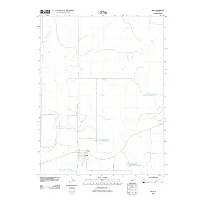
2010 Map of Simla
USGS Topo · Published 2010About this map
Simla serves as the central hub of this eastern Colorado landscape, situated at the intersection of Simla Hwy and County Hwy-127. The town's grid is clearly defined just north of the Big Sandy Creek valley, where the regional water management system is prominently displayed. A series of flood control structures, including the Big Sandy Creek Watershed S-16 Reservoir and Big Sandy Creek Watershed N-18 Reservoir, demonstrate the essential role of irrigation and water conservation in this semi-arid plains environment.
Find a feature on this map
20 named features on this map. Tap any name to fly to it.
Don’t see what you’re looking for? This feature index may not catch every label — zoom into the map to look around manually.
Map Details
Editions of this 2010 Simla Map
This is the sole edition of this map. No revisions or reprints were ever made.
Other maps of this area

1891 · Limon
USGS Topo · 1:125,000

1892 · Limon
USGS Topo · 1:125,000

1953 · Denver
USGS Topo · 1:250,000

1954 · Limon
USGS Topo · 1:250,000

1957 · Denver
USGS Topo · 1:250,000

1957 · Limon
USGS Topo · 1:250,000

1958 · Limon
USGS Topo · 1:250,000

1958 · Denver
USGS Topo · 1:250,000

1960 · Denver
USGS Topo · 1:250,000
1970 · Matheson SW
USGS Topo · 1:24,000