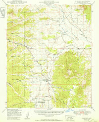
1950 Map of Simmons
USGS Topo · Published 1950About this map
Simmons stands as a focal point in this high-desert ranching landscape, situated where Mint Wash meets the southern reaches of the Chino Valley. The map reveals a post-war pattern of land use dominated by several significant family-named holdings, such as Wineglass Ranch and the Seven V Ranch, connected by a network of unimproved roads and a telephone line that traverses the northern reaches of the Prescott National Forest.
Find a feature on this map
34 named features on this map. Tap any name to fly to it.
Don’t see what you’re looking for? This feature index may not catch every label — zoom into the map to look around manually.
Map Details
Editions of this 1950 Simmons Map
2 editions found
Other maps of this area

1886 · Chino
USGS Topo · 1:250,000

1887 · Prescott
USGS Topo · 1:250,000

1891 · Chino
USGS Topo · 1:250,000

1892 · Prescott
USGS Topo · 1:250,000

1905 · Jerome
USGS Topo · 1:125,000

1922 · Williams
USGS Topo · 1:125,000

1947 · Ash Fork
USGS Topo · 1:62,500

1947 · Simmons
USGS Topo · 1:62,500

1947 · Iron Springs
USGS Topo · 1:62,500

1947 · Picacho Butte
USGS Topo · 1:62,500