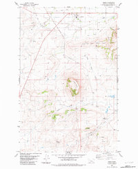
1983 Map of Simms
USGS Topo · Published 1983About this map
The Old Fort Shaw Military Reservation Boundary arches across this landscape, marking a significant historical frontier footprint in Cascade County. The settlement of Simms serves as a focal point near the northern edge, where the Old Railroad Grade and the Fort Shaw Canal trace the intersection of early transportation and irrigation infrastructure. The terrain is defined by prominent landmarks such as the volcanic-profile Crown Butte and Shaw Butte, which rise above the surrounding drainage networks of Little Muddy Creek and Birdtail Creek.
Find a feature on this map
25 named features on this map. Tap any name to fly to it.
Don’t see what you’re looking for? This feature index may not catch every label — zoom into the map to look around manually.
Map Details
Editions of this 1983 Simms Map
This is the sole edition of this map. No revisions or reprints were ever made.
Other maps of this area

1886 · Great Falls
USGS Topo · 1:250,000

1920 · Choteau
USGS Topo · 1:125,000

1943 · Hogan
USGS Topo · 1:125,000

1950 · Fairfield
USGS Topo · 1:62,500

1954 · Great Falls
USGS Topo · 1:250,000

1955 · Choteau
USGS Topo · 1:250,000

1957 · Choteau
USGS Topo · 1:250,000

1957 · Great Falls
USGS Topo · 1:250,000

1958 · Choteau
USGS Topo · 1:250,000

1960 · Simms
USGS Topo · 1:62,500