
1966 Map of Simms
USGS Topo · Published 1968About this map
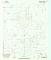
Palo Duro Creek winds through the southern reaches of this High Plains landscape, carving out the primary drainage feature in a region defined by agricultural utility and water management. The small settlement of Simms serves as the focal point of the area, situated at a junction near several benchmarks that underscore the precision of the mid-1960s topographic survey. The land is heavily marked by the search for resources and water, evidenced by the numerous Wells and an individual Well scattered across the grid-like sections, alongside a localized Gravel Pit that points to early industrial or road-building activity. The topographic lines illustrate the subtle but significant elevation changes that direct the flow of intermittent waters toward the creek bed, revealing how the local geography dictated the placement of homesteads and infrastructure in Deaf Smith County.
Find a feature on this map
5 named features on this map. Tap any name to fly to it.
Don’t see what you’re looking for? This feature index may not catch every label — zoom into the map to look around manually.
Map Details
Editions of this 1966 Simms Map
This is the sole edition of this map. No revisions or reprints were ever made.
Other maps of this area

1954 · Tucumcari
USGS Topo · 1:250,000

1954 · Clovis
USGS Topo · 1:250,000

1958 · Clovis
USGS Topo · 1:250,000

1958 · Tucumcari
USGS Topo · 1:250,000

1966 · Boise
USGS Topo · 1:24,000

1966 · Overstreet Lake
USGS Topo · 1:24,000

1966 · Simms NW
USGS Topo · 1:24,000

1966 · Simms NE
USGS Topo · 1:24,000

1966 · Norton Lake
USGS Topo · 1:24,000
1971 · Westway NW
USGS Topo · 1:24,000