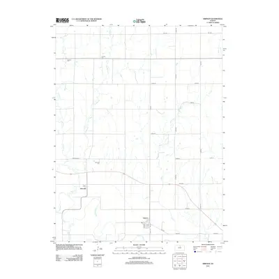
2012 Map of Simpson
USGS Topo · Published 2012About this map
Asherville and Simpson anchor this Mitchell County landscape, situated along the meandering path of the Solomon River. The area is defined by a dense network of watercourses, including the divided branches of W Asher Cr and E Asher Cr, which feed south toward the river valley. For genealogists and local historians, the map provides precise locations for several community landmarks, most notably the Asherville Cem, McBride Cem, and W Asher Cem. The settlement at Simpson is centered around Elm St and Mill St, where a Po serves the local population. This map reveals a grid-based rural infrastructure where named section roads like Asherville Rd and Eagle Rd connect outlying farmsteads to these small agricultural hubs.
Find a feature on this map
28 named features on this map. Tap any name to fly to it.
Don’t see what you’re looking for? This feature index may not catch every label — zoom into the map to look around manually.
Map Details
Editions of this 2012 Simpson Map
This is the sole edition of this map. No revisions or reprints were ever made.
Other maps of this area

1892 · Concordia
USGS Topo · 1:125,000

1892 · Minneapolis
USGS Topo · 1:125,000

1894 · Mankato
USGS Topo · 1:125,000

1894 · Beloit
USGS Topo · 1:125,000

1952 · Glasco SW
USGS Topo · 1:24,000

1952 · Glasco
USGS Topo · 1:24,000

1953 · Glasco NE
USGS Topo · 1:24,000

1953 · Simpson
USGS Topo · 1:24,000

1953 · Beloit
USGS Topo · 1:24,000

1955 · Manhattan
USGS Topo · 1:250,000