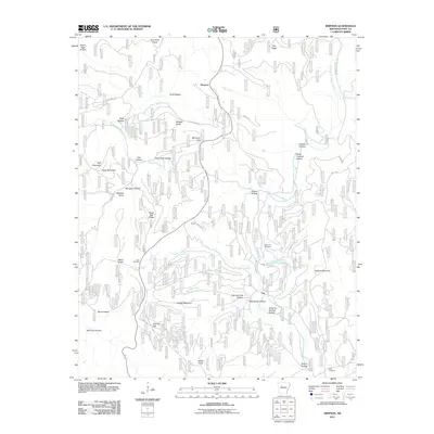
2011 Map of Simpson
USGS Topo · Published 2011About this map
The Simpson and Tag communities define the high-country landscape of northern Pope County in this recent survey. This area is characterized by a complex network of ridges and hollows drained by the North Fork Illinois Bayou and its many tributaries, including Cowan Creek, Moccasin Creek, and Bob Bates Fork. The terrain is marked by numerous family-named landmarks and historical sites such as Dare Mine Knob and the associated Dare Mine Rd, suggesting a legacy of local extraction. Genealogists will find notable points of interest in the Sherman Cemetery, Lane Cemetery, and Birch Cemetery, which are scattered among prominent elevations like High Mountain, Whaley Knob, and Middle Mountain. The transportation network is dominated by rural routes like Wootin Rd and Page Hollow Rd, tracing the paths between these isolated settlements and the deep drainages of Gulf Hollow and Epson Hollow.
Find a feature on this map
45 named features on this map. Tap any name to fly to it.
Don’t see what you’re looking for? This feature index may not catch every label — zoom into the map to look around manually.
Map Details
Editions of this 2011 Simpson Map
This is the sole edition of this map. No revisions or reprints were ever made.
Other maps of this area

1879 · Washington
USGS Topo · 1:62,500

1887 · Smyrna
USGS Topo · 1:62,500

1888 · Dardanelle #1
USGS Topo · 1:62,500

1889 · Treat
USGS Topo · 1:62,500

1889 · Marshall #3
USGS Topo · 1:62,500

1890 · Dardanelle
USGS Topo · 1:125,000

1892 · Marshall
USGS Topo · 1:125,000

1892 · Morrillton
USGS Topo · 1:125,000

1894 · Morrillton
USGS Topo · 1:125,000

1894 · Marshall
USGS Topo · 1:125,000