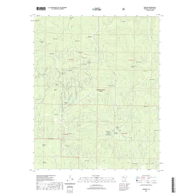
2020 Map of Simpson
USGS Topo · Published 2020About this map
Ozark National Forest terrain dominates this Pope County landscape, where the ridges and hollows are etched with the history of timber and mining. The small settlement of Simpson sits near Oak Grove Cem, while the surrounding hills like Dare Mine Knob and the rugged Black Oak Ridge speak to the region's industrial and geological character. This 2020 survey provides a contemporary view of a wilderness that remains shaped by traditional land use, from the logging legacy suggested by Stave Mill Hollow to the network of recreational and service roads like Gap Hollow Loop.
Find a feature on this map
83 named features on this map. Tap any name to fly to it.
Don’t see what you’re looking for? This feature index may not catch every label — zoom into the map to look around manually.
Map Details
Editions of this 2020 Simpson Map
This is the sole edition of this map. No revisions or reprints were ever made.
Other maps of this area

1879 · Washington
USGS Topo · 1:62,500

1887 · Smyrna
USGS Topo · 1:62,500

1888 · Dardanelle #1
USGS Topo · 1:62,500

1889 · Treat
USGS Topo · 1:62,500

1889 · Marshall #3
USGS Topo · 1:62,500

1890 · Dardanelle
USGS Topo · 1:125,000

1892 · Marshall
USGS Topo · 1:125,000

1892 · Morrillton
USGS Topo · 1:125,000

1894 · Morrillton
USGS Topo · 1:125,000

1894 · Marshall
USGS Topo · 1:125,000