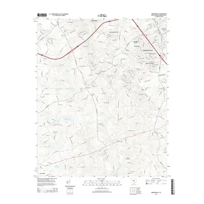
2014 Map of Simpsonville
USGS Topo · Published 2014About this map
Simpsonville and Mauldin anchor this portrait of the Greenville County suburban landscape during a period of significant growth. The area is defined by a dense network of residential developments such as Pine Brook Forest, Cherokee Heights, and Hunters Woods, which are interspersed with long-standing rural landmarks. Numerous burial grounds, including the Antioch Cem and the Simpsonville Municipal Cem, offer vital locations for genealogical research.
Find a feature on this map
219 named features on this map. Tap any name to fly to it.
Don’t see what you’re looking for? This feature index may not catch every label — zoom into the map to look around manually.
Map Details
Editions of this 2014 Simpsonville Map
This is the sole edition of this map. No revisions or reprints were ever made.
Other maps of this area

1935 · Greer
USGS Topo · 1:48,000

1935 · Greenville
USGS Topo · 1:48,000

1938 · Greenville
USGS Topo · 1:62,500

1938 · Greer
USGS Topo · 1:62,500

1954 · Greenville
USGS Topo · 1:250,000

1957 · Fountain Inn
USGS Topo · 1:62,500

1957 · Greenville
USGS Topo · 1:24,000

1957 · Williamston
USGS Topo · 1:62,500

1957 · Greer
USGS Topo · 1:62,500

1957 · Greenville
USGS Topo · 1:62,500
Featured Places
- Mauldin, SC
- Simpsonville, SC
- Westwood, Simpsonville
- Cherokee Heights, Simpsonville
- Greenville County, SC