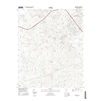
2017 Map of Simpsonville
USGS Topo · Published 2017About this map
The Simpsonville area of Greenville County is defined by the winding course of the Reedy River, which flows south through a landscape increasingly marked by residential development and infrastructure. Numerous historical burials are preserved across the region, from the Simpsonville Municipal Cem in the northeast to outlying family and community sites like Cureton Cem and Pisgah Cem. The map illustrates a dense network of water management features, including Water Shed Number One Reservoir, Kelletts Lake, and several other numbered reservoirs that punctuate the terrain. Long-standing crossings such as Log Shoals Bridge, Huff Bridge, and Jenkins Bridge anchor the transportation network, connecting the growing suburban fringes of Mauldin with more rural reaches toward Ware Place. This modern survey documents the transition of Piedmont farmland into a managed suburban corridor while retaining the names of the early churches and families who settled the river banks.
Find a feature on this map
222 named features on this map. Tap any name to fly to it.
Don’t see what you’re looking for? This feature index may not catch every label — zoom into the map to look around manually.
Map Details
Editions of this 2017 Simpsonville Map
This is the sole edition of this map. No revisions or reprints were ever made.
Other maps of this area

1935 · Greer
USGS Topo · 1:48,000

1935 · Greenville
USGS Topo · 1:48,000

1938 · Greenville
USGS Topo · 1:62,500

1938 · Greer
USGS Topo · 1:62,500

1954 · Greenville
USGS Topo · 1:250,000

1957 · Fountain Inn
USGS Topo · 1:62,500

1957 · Greenville
USGS Topo · 1:24,000

1957 · Williamston
USGS Topo · 1:62,500

1957 · Greer
USGS Topo · 1:62,500

1957 · Greenville
USGS Topo · 1:62,500
Featured Places
- Mauldin, SC
- Simpsonville, SC
- Westwood, Simpsonville
- Cherokee Heights, Simpsonville
- Greenville County, SC