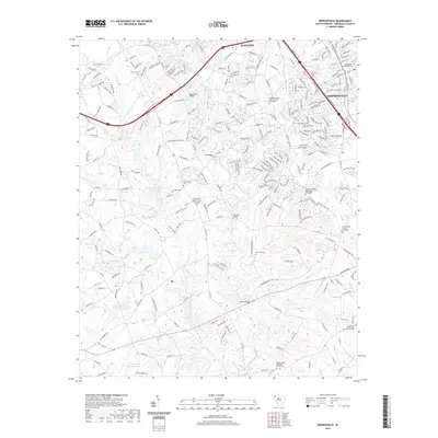
2020 Map of Simpsonville
USGS Topo · Published 2020About this map
The Reedy River system anchors this landscape south of Mauldin, where the Piedmont terrain is defined by a dense network of watercourses and early rural crossings. Distinctive landmarks like Log Shoals Bridge, Huff Bridge, and Jenkins Bridge reveal the historical importance of river navigation and connectivity in this part of Greenville County. For genealogists and local historians, the sheet is an exceptional resource, recording numerous legacy burial grounds including the Standing Springs Baptist Church Graveyard and Fairview Presbyterian Church Graveyard. The suburban expansion of Simpsonville is visible in the northeastern corner, contrasting with the more rural southern sections where the landscape is dotted with small impoundments such as Snows Lake and Kelletts Lake, alongside larger utility reservoirs.
Find a feature on this map
254 named features on this map. Tap any name to fly to it.
Don’t see what you’re looking for? This feature index may not catch every label — zoom into the map to look around manually.
Map Details
Editions of this 2020 Simpsonville Map
This is the sole edition of this map. No revisions or reprints were ever made.
Other maps of this area

1935 · Greer
USGS Topo · 1:48,000

1935 · Greenville
USGS Topo · 1:48,000

1938 · Greenville
USGS Topo · 1:62,500

1938 · Greer
USGS Topo · 1:62,500

1954 · Greenville
USGS Topo · 1:250,000

1957 · Fountain Inn
USGS Topo · 1:62,500

1957 · Greenville
USGS Topo · 1:24,000

1957 · Williamston
USGS Topo · 1:62,500

1957 · Greer
USGS Topo · 1:62,500

1957 · Greenville
USGS Topo · 1:62,500
Featured Places
- Mauldin, SC
- Simpsonville, SC
- Westwood, Simpsonville
- Cherokee Heights, Simpsonville
- Greenville County, SC