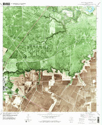
1979 Map of Sinton East
USGS Topo · Published 1979About this map
The coastal plains of San Patricio County are defined by a complex intersection of energy extraction and transportation networks in the late 1970s. The landscape is heavily marked by the Portilla Oil and Gas Field and the Plymouth Oil and Gas Field, with numerous drill holes and pumping stations scattered across the terrain. This industrial footprint is anchored by the eastern edge of Sinton, where the High Sch and Radio Towers (KIKN) serve as local landmarks near the junction of the Southern Pacific and Missouri Pacific railroads. Natural drainage systems like the Aransas River and Chiltipin Creek wind through the region, creating a stark contrast between the riparian corridors and the geometric patterns of the surrounding oil fields and agricultural tracts. The map also captures smaller locales like Moody and specialized infrastructure such as a Heliport and several wind-driven water sources including the Lagarto Windmill.
Find a feature on this map
29 named features on this map. Tap any name to fly to it.
Don’t see what you’re looking for? This feature index may not catch every label — zoom into the map to look around manually.
Map Details
Editions of this 1979 Sinton East Map
2 editions found
Other maps of this area

1925 · Robstown
USGS Topo · 1:62,500

1925 · Corpus Christi
USGS Topo · 1:62,500

1950 · Corpus Christi
USGS Topo · 1:250,000

1951 · Corpus Christi
USGS Topo · 1:62,500

1953 · Beeville
USGS Topo · 1:250,000

1954 · Woodsboro
USGS Topo · 1:62,500

1954 · Robstown
USGS Topo · 1:62,500

1954 · Sinton
USGS Topo · 1:62,500

1956 · Corpus Christi
USGS Topo · 1:250,000

1956 · Beeville
USGS Topo · 1:250,000
Featured Places
- Sinton, TX
- Ewelder, TX
- Rancho Chico Addition Colonia, TX
- Second Rancho Chico Additio Colonia, TX
- O'Farrell Acres Number 1 Colonia, TX