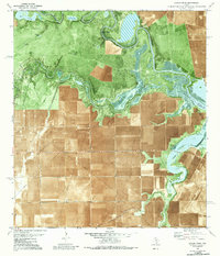
1979 Map of Rincon Bend
USGS Topo · Published 1987About this map
The Aransas River defines the landscape of this Gulf Coast survey, winding through a complex network of wetlands and tidal areas including Mud Flats and the sharp oxbow of Rincon Bend. The region is a productive intersection of coastal agriculture and heavy industry, dominated by the sprawling Plymouth Oil and Gas Field and the Taft Oil and Gas Field. A series of pipelines and access roads cut across the terrain, servicing numerous wells and drill holes. Evidence of local agricultural operations remains visible at the Cotton Gin and a variety of family or place-named water features like Paloma Tank and Chico Tank. The presence of the Taft Drainage Ditch suggests the historical efforts required to manage the low-lying coastal prairie for industrial and farming use during the late 1970s.
Find a feature on this map
32 named features on this map. Tap any name to fly to it.
Don’t see what you’re looking for? This feature index may not catch every label — zoom into the map to look around manually.
Map Details
Editions of this 1979 Rincon Bend Map
This is the sole edition of this map. No revisions or reprints were ever made.
Other maps of this area

1925 · Aransas Pass
USGS Topo · 1:62,500

1925 · Corpus Christi
USGS Topo · 1:62,500

1950 · Corpus Christi
USGS Topo · 1:250,000

1951 · Corpus Christi
USGS Topo · 1:62,500

1953 · Beeville
USGS Topo · 1:250,000

1954 · Rockport
USGS Topo · 1:62,500

1954 · Aransas Pass
USGS Topo · 1:24,000

1954 · Woodsboro
USGS Topo · 1:62,500

1954 · Aransas Pass
USGS Topo · 1:62,500

1956 · Corpus Christi
USGS Topo · 1:250,000