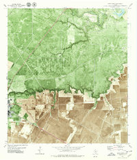
1979 Map of Sinton East
USGS Topo · Published 1979About this map
The industrial and agricultural landscape of San Patricio Co comes into focus through this late-1970s orthophoto study, where energy extraction and rail transit dominate the terrain. Heavy activity is concentrated in the Portilla Oil and Gas Field and Plymouth Oil and Gas Field, while a network of pipelines crisscrosses the coastal plains. The city of Sinton serves as a primary hub on the western edge, marked by its High Sch and infrastructure like the Radio Towers (KIKN).
Find a feature on this map
27 named features on this map. Tap any name to fly to it.
Don’t see what you’re looking for? This feature index may not catch every label — zoom into the map to look around manually.
Map Details
Editions of this 1979 Sinton East Map
2 editions found
Other maps of this area

1925 · Robstown
USGS Topo · 1:62,500

1925 · Corpus Christi
USGS Topo · 1:62,500

1950 · Corpus Christi
USGS Topo · 1:250,000

1951 · Corpus Christi
USGS Topo · 1:62,500

1953 · Beeville
USGS Topo · 1:250,000

1954 · Woodsboro
USGS Topo · 1:62,500

1954 · Robstown
USGS Topo · 1:62,500

1954 · Sinton
USGS Topo · 1:62,500

1956 · Corpus Christi
USGS Topo · 1:250,000

1956 · Beeville
USGS Topo · 1:250,000
Featured Places
- Sinton, TX
- Ewelder, TX
- Rancho Chico Addition Colonia, TX
- Second Rancho Chico Additio Colonia, TX
- O'Farrell Acres Number 1 Colonia, TX