
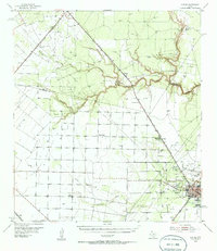
1954 Map of Sinton
USGS Topo · Published 1956About this map
The city of Sinton serves as a major hub for rail and petroleum activity in mid-century San Patricio County, situated at the junction of the Missouri Pacific and the Texas and New Orleans railroads. The landscape is heavily marked by the region's mid-century energy boom, particularly within the East Mathis Oil Field and the Sinton Oil Field, where extensive pipeline networks and infrastructure like the Humline Pumping Sta Oil Tanks and Plymouth Oil Camp are prominent.
Find a feature on this map
27 named features on this map. Tap any name to fly to it.
Don’t see what you’re looking for? This feature index may not catch every label — zoom into the map to look around manually.
Map Details
Editions of this 1954 Sinton Map
2 editions found
Other maps of this area

1925 · Robstown
USGS Topo · 1:62,500

1925 · Corpus Christi
USGS Topo · 1:62,500

1927 · Mathis
USGS Topo · 1:62,500

1950 · Corpus Christi
USGS Topo · 1:250,000

1951 · Corpus Christi
USGS Topo · 1:62,500

1953 · Beeville
USGS Topo · 1:250,000

1954 · Orange Grove
USGS Topo · 1:62,500

1954 · Skidmore
USGS Topo · 1:62,500

1954 · Fleming
USGS Topo · 1:62,500

1954 · Woodsboro
USGS Topo · 1:62,500
Featured Places
- Sinton, TX
- Loma Linda Colonia, TX
- Gonzales 12 Colonia, TX
- Sun Country Estates Colonia, TX
- Sunkist Country Estates Colonia, TX