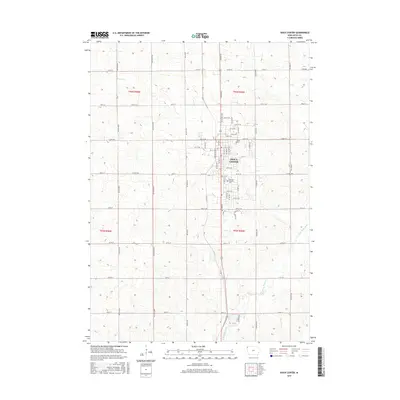
2015 Map of Sioux Center
USGS Topo · Published 2015About this map
Sioux Center serves as the focal point of this Northwest Iowa landscape, where the structured grid of Sioux County meets the winding course of the W Br Floyd River. The map captures the community during a period of steady expansion, clearly delineating the campus of Dordt Coll and the quiet grounds of Memory Gardens Cem. Surrounding the town, the rural terrain is defined by a dense network of sectional roads like Garfield Ave and Goldfinch Ave, reflecting the region’s deep agricultural foundations. Small drainage features such as Sixmile Cr cut through the fields, illustrating the local hydrology that dictated early farmstead placement and road crossings. This survey provides a precise look at the 21st-century configuration of residential streets and arterial highways like Co Hwy B44 that connect this regional hub to the broader Iowa prairie.
Find a feature on this map
72 named features on this map. Tap any name to fly to it.
Don’t see what you’re looking for? This feature index may not catch every label — zoom into the map to look around manually.
Map Details
Editions of this 2015 Sioux Center Map
This is the sole edition of this map. No revisions or reprints were ever made.
Other maps of this area

1955 · Sioux City
USGS Topo · 1:250,000

1955 · Sioux Falls
USGS Topo · 1:250,000

1958 · Sioux City
USGS Topo · 1:250,000

1958 · Sioux Falls
USGS Topo · 1:250,000

1959 · Sioux City
USGS Topo · 1:250,000

1962 · Le Mars
USGS Topo · 1:62,500

1964 · Orange City
USGS Topo · 1:24,000

1964 · Boyden
USGS Topo · 1:24,000

1964 · Sioux Center
USGS Topo · 1:24,000

1964 · Hull
USGS Topo · 1:24,000