
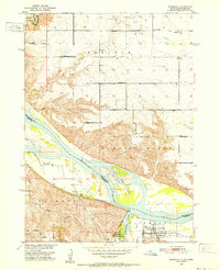
1959 Map of Sioux City
USGS Topo · Published 1959About this map
The Missouri River serves as the central artery for this mid-century landscape, carving a border between South Dakota, Nebraska, and Iowa. In the northwest, the Yankton Indian Reservation borders the recently formed Lewis and Clark Lake, while further downstream, the Winnebago Indian Reservation and Omaha Indian Reservation occupy the Nebraska side of the valley. The hub of Sioux City is shown just before the major expansion of the interstate system, with its regional connections still heavily reliant on the Chicago and North Western and Illinois Central railroads. The rural character of the surrounding counties is meticulously documented through an exhaustive network of numbered country schools, such as Reading School No 5 and Washington School No 3, alongside landmarks like the Norfolk State Hospital and St Johns Church and School.
Find a feature on this map
253 named features on this map. Tap any name to fly to it.
Don’t see what you’re looking for? This feature index may not catch every label — zoom into the map to look around manually.
Map Details
Editions of this 1959 Sioux City Map
This is the sole edition of this map. No revisions or reprints were ever made.
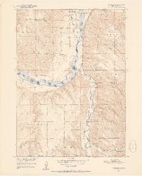
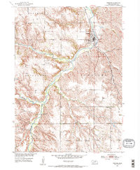
Other maps of this area

1897 · Canton
USGS Topo · 1:125,000

1898 · Olivet
USGS Topo · 1:125,000

1898 · Parker
USGS Topo · 1:125,000

1898 · Elk Point
USGS Topo · 1:125,000

1900 · Canton
USGS Topo · 1:125,000

1901 · Elk Point
USGS Topo · 1:125,000

1907 · Elk Point
USGS Topo · 1:125,000
1950 · Niobrara
USGS Topo · 1:24,000
1950 · Verdigre NE
USGS Topo · 1:24,000
1954 · Verdigre
USGS Topo · 1:24,000