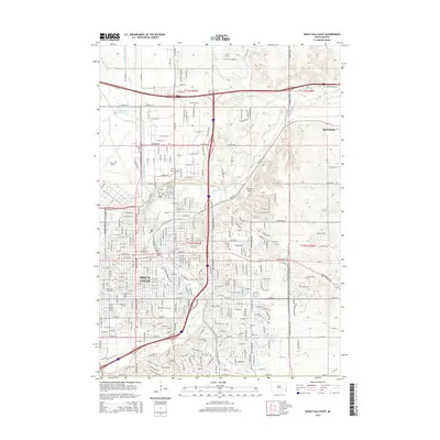
2015 Map of Sioux Falls East
USGS Topo · Published 2015About this map
Sioux Falls and its eastern expansion toward Brandon are defined by the winding course of the Big Sioux River and a complex network of water management. The city's landscape is shaped by the Sioux Falls Diversion Channel and Diversion Canal, protecting the urban core and Joe Foss Field from the river's floods. This era shows a thriving educational hub, with Augustana College, the University of Sioux Falls, Sioux Falls Seminary, and Kilian Community College all established within the city grid.
Find a feature on this map
126 named features on this map. Tap any name to fly to it.
Don’t see what you’re looking for? This feature index may not catch every label — zoom into the map to look around manually.
Map Details
Editions of this 2015 Sioux Falls East Map
This is the sole edition of this map. No revisions or reprints were ever made.
Other maps of this area

1897 · Canton
USGS Topo · 1:125,000

1900 · Canton
USGS Topo · 1:125,000

1955 · Sioux Falls
USGS Topo · 1:250,000

1958 · Sioux Falls
USGS Topo · 1:250,000

1962 · Renner
USGS Topo · 1:24,000

1962 · Klondike
USGS Topo · 1:24,000

1962 · Harrisburg
USGS Topo · 1:24,000

1962 · Brandon
USGS Topo · 1:24,000

1962 · Sioux Falls East
USGS Topo · 1:24,000

1962 · Tea
USGS Topo · 1:24,000
Featured Places
- Sioux Falls, SD
- Brandon, SD
- Split Rock Township, SD
- Anderson Subdivision, SD
- Froelich Addition, Sioux Falls