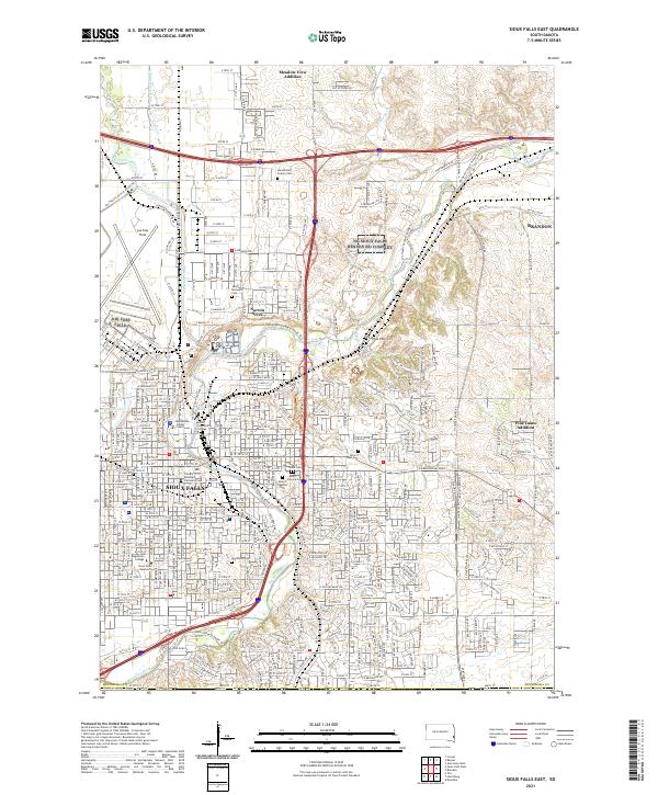
2021 Map of Sioux Falls East
USGS Topo · Published 2021About this map
The Big Sioux River and the Diversion Canal define the urban and suburban structure of eastern Sioux Falls and its neighboring city Brandon. This landscape represents a sophisticated intersection of modern development and civic institutions, featuring a concentration of academic and religious landmarks such as Augustana College, the University of Sioux Falls, and the Sioux Falls Seminary. The map provides a detailed view of several residential additions, including Meadow View Addition and Norton Acres, while tracking the recreational and navigational paths like the Jay Heath Canoe & Kayak Trail. Large-scale infrastructure is also prominent, from the wide footprint of Joe Foss Field in the northwest to the complex of municipal services centered near the Minnehaha County Courthouse. This 2021 survey also preserves the locations of numerous historic burial grounds, including the Hills of Rest Cemetery and the Sons of Israel Cemetery, which serve as vital points for genealogical research.
Find a feature on this map
33 named features on this map. Tap any name to fly to it.
Don’t see what you’re looking for? This feature index may not catch every label — zoom into the map to look around manually.
Map Details
Editions of this 2021 Sioux Falls East Map
This is the sole edition of this map. No revisions or reprints were ever made.
Other maps of this area

1897 · Canton
USGS Topo · 1:125,000

1900 · Canton
USGS Topo · 1:125,000

1955 · Sioux Falls
USGS Topo · 1:250,000

1958 · Sioux Falls
USGS Topo · 1:250,000

1962 · Renner
USGS Topo · 1:24,000

1962 · Klondike
USGS Topo · 1:24,000

1962 · Harrisburg
USGS Topo · 1:24,000

1962 · Brandon
USGS Topo · 1:24,000

1962 · Sioux Falls East
USGS Topo · 1:24,000

1962 · Tea
USGS Topo · 1:24,000