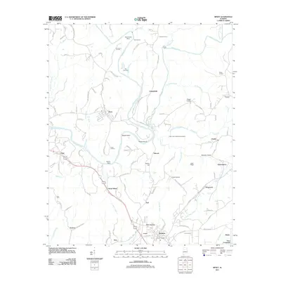
2011 Map of Sipsey
USGS Topo · Published 2011About this map
The Mulberry Fork and Sipsey Fork converge in this part of Walker County, defining a landscape of sharp river bends and complex creek systems. Significant water-control and navigational features are evident, including the Bill Grey Dam, the Little Creek Impoundment Dams, and natural landmarks like Phillips Shoals and Baltimore Ford. The settlement pattern centers on the corridor between Sumiton and Argo, where the Sumiton Post Office serves as a modern anchor. Smaller communities and named locales such as Dilworth, Empire, Campbellville, and Debardeleben are scattered across the terrain, connected by a dense network of local roads like Riggs Chapel Rd and Campbellville Rd. Genealogists will find a wealth of family-named sites, from the numerous burial grounds including Drummond Cemetery and New Canaan Cemetery to geographic features like Drummond Bend, Magbee Bend, and Allen Ridge. The presence of the Bush Tower and various hollows like Rocky Hollow and Tucker Hollow further detail the local topography.
Find a feature on this map
128 named features on this map. Tap any name to fly to it.
Don’t see what you’re looking for? This feature index may not catch every label — zoom into the map to look around manually.
Map Details
Editions of this 2011 Sipsey Map
This is the sole edition of this map. No revisions or reprints were ever made.
Other maps of this area

1889 · Birmingham
USGS Topo · 1:125,000

1892 · Birmingham
USGS Topo · 1:125,000

1893 · Jasper
USGS Topo · 1:125,000

1895 · Birmingham
USGS Topo · 1:125,000

1904 · Birmingham Coal District
USGS Topo · 1:62,500

1906 · Birmingham Special
USGS Topo · 1:62,500

1907 · Birmingham
USGS Topo · 1:125,000

1935 · Port Birmingham
USGS Topo · 1:48,000

1938 · Port Birmingham
USGS Topo · 1:62,500

1949 · Cordova
USGS Topo · 1:24,000