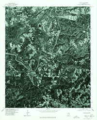
1975 Map of Sipsey
USGS Topo · Published 1977About this map
Sipsey and the northern edge of Sumiton define the populated centers of this 1975 orthophotoquad. Unlike traditional topographic maps, this aerial imagery provides a direct visual record of the land surface, revealing the winding course of the Sipsey River as it snakes through the wooded terrain of Walker County. The imagery captures the distinct patterns of vegetation and clearing that characterize the area during the mid-1970s, showing the intersection of rural residential development and the natural river corridor. Local researchers can use this aerial perspective to identify property boundaries, old road alignments, and the footprint of the landscape before more recent suburban expansion and reforestation.
Find a feature on this map
2 named features on this map. Tap any name to fly to it.
Don’t see what you’re looking for? This feature index may not catch every label — zoom into the map to look around manually.
Map Details
Editions of this 1975 Sipsey Map
This is the sole edition of this map. No revisions or reprints were ever made.
Other maps of this area

1889 · Birmingham
USGS Topo · 1:125,000

1892 · Birmingham
USGS Topo · 1:125,000

1893 · Jasper
USGS Topo · 1:125,000

1895 · Birmingham
USGS Topo · 1:125,000

1904 · Birmingham Coal District
USGS Topo · 1:62,500

1906 · Birmingham Special
USGS Topo · 1:62,500

1907 · Birmingham
USGS Topo · 1:125,000

1935 · Port Birmingham
USGS Topo · 1:48,000

1938 · Port Birmingham
USGS Topo · 1:62,500

1949 · Cordova
USGS Topo · 1:24,000