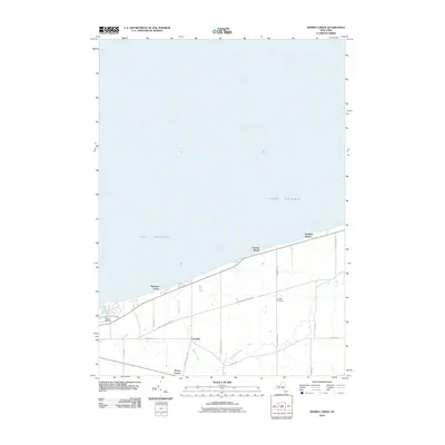
2010 Map of Sixmile Creek
USGS Topo · Published 2010About this map
Lake Ontario defines the northern reaches of this Niagara County landscape, where the shoreline is punctuated by small clusters like Hopkins Beach, Uneeda Beach, and Harrison Grove. Moving inland, the terrain transition is marked by the winding courses of Sixmile Creek and Twelvemile Creek, which drain the agricultural and residential lands of Porter. The settlement pattern here is anchored by small historical crossroads such as Porter Center and Tryonville, connected by a grid of local thoroughfares including Youngstown Wilson Rd and Ransonville Rd. For those researching local history or genealogy, the map provides precise locations for Oakland Cemetery and Halsted Cemetery, offering a detailed look at the rural character of this region as it appeared in the early 21st century. The map also traces the path of the Robert Moses Pkwy as it skims the lakefront, illustrating the transportation infrastructure serving this coastal community.
Find a feature on this map
21 named features on this map. Tap any name to fly to it.
Don’t see what you’re looking for? This feature index may not catch every label — zoom into the map to look around manually.
Map Details
Editions of this 2010 Sixmile Creek Map
This is the sole edition of this map. No revisions or reprints were ever made.
Other maps of this area

1894 · Niagara Falls
USGS Topo · 1:62,500

1894 · Wilson
USGS Topo · 1:62,500

1896 · Niagara Falls
USGS Topo · 1:62,500

1897 · Tonawanda
USGS Topo · 1:62,500

1899 · Niagara
USGS Topo · 1:125,000

1900 · Wilson
USGS Topo · 1:62,500

1900 · Tonawanda
USGS Topo · 1:62,500

1900 · Niagara Falls
USGS Topo · 1:62,500

1901 · Niagara Falls
USGS Topo · 1:62,500

1901 · Tonawanda
USGS Topo · 1:62,500